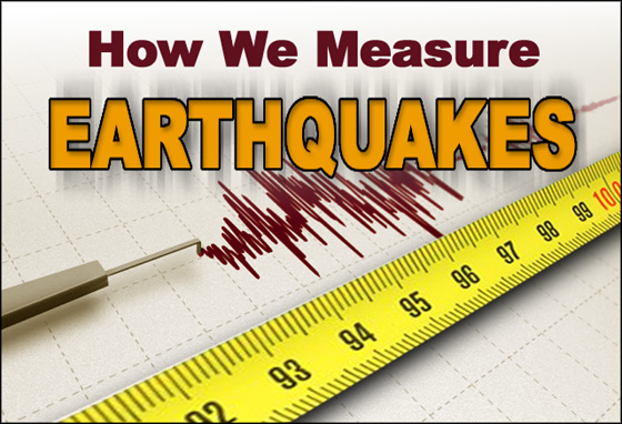
Decoding Seismic Waves: How They Determine an Earthquake's Magnitude and Intensity
Imagine the earth rumbling beneath your feet, a terrifying reminder of the immense power held within our planet. But how do scientists unravel the mysteries of these seismic events? The key lies in decoding seismic waves, those vibrations that radiate outward from an earthquake's source. By meticulously analyzing these waves, we can pinpoint an earthquake's magnitude, essentially its size, and its intensity, a measure of the shaking experienced at different locations.
Understanding Seismic Waves: The Messengers of Earthquakes
Earthquakes generate several types of seismic waves, each traveling at different speeds and through different materials. The primary waves, or P-waves, are compressional waves, meaning they push and pull the material they travel through, much like sound waves. These are the fastest seismic waves and can travel through solids, liquids, and gases. Secondary waves, or S-waves, are shear waves, moving material perpendicular to their direction of travel. S-waves are slower than P-waves and, crucially, cannot travel through liquids. The difference in arrival times between P-waves and S-waves at seismograph stations is a crucial factor in determining the distance to the earthquake's epicenter. This travel time difference, meticulously recorded, is the first step in locating the quake's origin.
Surface waves, as the name suggests, travel along the Earth's surface. These are generally slower than both P-waves and S-waves but often have larger amplitudes, making them responsible for much of the damage associated with earthquakes. There are two main types of surface waves: Love waves, which are shear waves that travel horizontally, and Rayleigh waves, which are a combination of compressional and shear motions, causing the ground to roll in a similar fashion to ocean waves. Analyzing the characteristics of these different wave types helps us paint a complete picture of the earthquake event.
Magnitude: Quantifying the Size of an Earthquake
The magnitude of an earthquake is a quantitative measure of the energy released at its source. The most well-known magnitude scale is the Richter scale, developed by Charles Richter in 1935. While still sometimes referenced, the Richter scale has limitations, particularly for large earthquakes and earthquakes at significant distances from the seismograph. Modern seismologists now commonly use the moment magnitude scale, which is more accurate for larger events and is based on the seismic moment, a measure of the area of the fault that ruptured, the amount of slip along the fault, and the rigidity of the rocks. The moment magnitude provides a better estimation of the earthquake's total energy.
The magnitude scale is logarithmic, meaning that each whole number increase represents a tenfold increase in the amplitude of the seismic waves and roughly a 32-fold increase in the energy released. Therefore, an earthquake of magnitude 6 is ten times larger in amplitude and releases about 32 times more energy than an earthquake of magnitude 5. This exponential relationship highlights the vast differences in power between even relatively small increments on the scale. The accurate earthquake magnitude estimation is crucial for understanding the overall impact of the event.
Intensity: Measuring the Shaking Experienced
While magnitude quantifies the energy released, intensity measures the effects of an earthquake at a specific location. Intensity is a qualitative measure, based on observations of damage to structures, changes in the natural environment, and reports from people who experienced the shaking. The most commonly used intensity scale is the Modified Mercalli Intensity Scale, which assigns Roman numerals from I (not felt) to XII (total destruction) based on the observed effects.
Intensity varies depending on factors such as the distance from the epicenter, the local geology, and the quality of construction. An earthquake of a given magnitude will produce different intensities in different areas. For example, areas built on soft sediments will typically experience greater shaking than areas built on solid bedrock. The earthquake intensity scale provides valuable information for emergency response and urban planning, helping us understand the potential impact on different communities.
Seismographs: Capturing the Earth's Vibrations
Seismographs are the instruments used to detect and record seismic waves. Modern seismographs are highly sensitive and can detect even the smallest vibrations. They typically consist of a mass suspended from a frame, with a system to record the relative motion between the mass and the frame. When seismic waves arrive, the frame moves with the ground, while the inertia of the mass tends to keep it stationary. This relative motion is recorded, providing a seismogram, a visual representation of the ground motion over time.
Seismograph networks are distributed around the world, constantly monitoring the Earth's seismic activity. These networks provide data that is used to locate earthquakes, determine their magnitudes and intensities, and study the Earth's interior. The data recorded by these instruments are fundamental to seismograph analysis and interpreting the characteristics of seismic events.
Locating the Epicenter: Triangulation Techniques
Determining the location of an earthquake's epicenter (the point on the Earth's surface directly above the focus, or hypocenter, where the earthquake originates) relies on a process called triangulation. This involves using data from at least three seismograph stations. By measuring the difference in arrival times between P-waves and S-waves at each station, scientists can calculate the distance from each station to the epicenter.
These distances are then plotted as circles on a map, with each station at the center of its respective circle. The point where the three circles intersect represents the location of the epicenter. In reality, the circles may not intersect perfectly due to various factors, such as variations in the Earth's crustal structure. Sophisticated computer algorithms are used to refine the location and estimate the uncertainty in the epicenter determination. The accurate earthquake epicenter location is essential for understanding fault line behavior.
The Role of Fault Lines in Earthquake Generation
Earthquakes are primarily caused by the movement of tectonic plates along fault lines. These plates are constantly moving, albeit very slowly, and the stress that builds up along their boundaries eventually exceeds the strength of the rocks, causing a sudden rupture and release of energy in the form of seismic waves. Different types of faults exist, each with its own characteristic motion. Strike-slip faults involve horizontal movement, dip-slip faults involve vertical movement, and oblique-slip faults involve a combination of both.
The type of fault and the characteristics of the surrounding rocks influence the nature of the resulting earthquake. For example, earthquakes along subduction zones, where one plate is forced beneath another, can be particularly large and destructive. Understanding the fault line analysis provides insight into the processes driving seismic activity.
Seismic Wave Velocity and Earth's Interior
Seismic waves not only help us understand earthquakes but also provide valuable information about the Earth's interior. By analyzing the travel times and paths of seismic waves as they pass through the Earth, scientists can infer the properties of different layers, such as their density, composition, and state (solid or liquid). The fact that S-waves cannot travel through the Earth's outer core, for example, is a key piece of evidence that the outer core is liquid.
Changes in seismic wave velocity at certain depths indicate boundaries between different layers, such as the crust-mantle boundary (the Moho discontinuity) and the core-mantle boundary. The study of seismic wave velocities and their variations is a fundamental tool in geophysics, allowing us to create detailed models of the Earth's internal structure. The seismic wave analysis plays a crucial role in the understanding of Earth's deep interior.
Earthquake Early Warning Systems: A Race Against Time
Earthquake early warning systems aim to detect an earthquake as it begins and provide a warning to areas that will be affected by the stronger shaking. These systems rely on the fact that P-waves travel faster than S-waves and surface waves. By detecting the arrival of the P-waves at seismographs near the epicenter, a warning can be issued before the slower, more destructive waves arrive.
The amount of warning time available depends on the distance from the epicenter, but even a few seconds of warning can be enough to take protective actions, such as ducking and covering, shutting down critical systems, or stopping trains. Earthquake early warning systems are becoming increasingly sophisticated and are being implemented in earthquake-prone regions around the world. These earthquake warning systems are a key element in hazard mitigation.
| Earthquake Type | Typical Magnitude Range | Potential Effects |
|---|---|---|
| Minor | 1.0 - 3.9 |
Often not felt; minor shaking |
| Light | 4.0 - 4.9 |
Felt by many; minor damage possible |
| Moderate | 5.0 - 5.9 |
Can cause damage to poorly constructed buildings |
| Strong | 6.0 - 6.9 |
Can cause damage in populated areas |
| Major | 7.0 - 7.9 |
Widespread damage likely |
| Great | 8.0 - 8.9 |
Severe damage and collapse of buildings |
| Exceptional | 9.0+ | Catastrophic damage; widespread destruction |
| Modified Mercalli Intensity Scale | Observed Effects |
|---|---|
| I | Not felt |
| II | Felt by few; hanging objects may swing |
| III | Felt quite noticeably indoors |
| IV | Felt by many indoors; rattling windows |
| V | Felt by nearly everyone; some dishes broken |
| VI | Felt by all; some heavy furniture moved |
| VII | Damage negligible in buildings of good design and construction; considerable in poorly built structures |
| VIII | Damage slight in specially designed structures; considerable in ordinary substantial buildings |
| IX | Damage considerable in specially designed structures; well-designed frame structures thrown out of plumb |
| X | Most masonry and frame structures destroyed |
| XI | Few, if any, masonry structures remain standing |
| XII | Total damage; waves seen on ground surface |
FAQ: Decoding Seismic Waves
Q: How quickly can scientists determine the magnitude of an earthquake?
A: With modern seismograph networks and automated processing systems, scientists can often determine the preliminary magnitude of an earthquake within minutes of its occurrence. More precise magnitude estimations, particularly using the moment magnitude scale, may take longer as they require more detailed analysis of the seismic waveforms.
Q: Can earthquakes be predicted?
A: While scientists can identify areas at high risk of earthquakes based on plate tectonics and past seismic activity, predicting the exact time, location, and magnitude of a future earthquake remains a significant challenge. Current research focuses on identifying potential precursors to earthquakes, such as changes in ground deformation, seismic activity patterns, and groundwater chemistry, but reliable earthquake prediction is not yet possible. The understanding of earthquake prediction is always evolving.
Q: What is the difference between magnitude and intensity?
A: Magnitude is a measure of the energy released at the source of an earthquake, while intensity is a measure of the shaking experienced at a particular location. Magnitude is a single value for a given earthquake, while intensity varies depending on factors such as distance from the epicenter, local geology, and building construction.
Q: How are seismic waves used to study the Earth's interior?
A: By analyzing the travel times and paths of seismic waves as they pass through the Earth, scientists can infer the properties of different layers, such as their density, composition, and state (solid or liquid). Changes in seismic wave velocity at certain depths indicate boundaries between different layers, providing valuable information about the Earth's internal structure. This understanding of seismic wave propagation is key to geological research.
Conclusion
Decoding seismic waves is a complex but crucial endeavor. By carefully analyzing these vibrations, we can determine the magnitude and intensity of earthquakes, understand the processes that generate them, and even probe the depths of our planet. As our understanding of seismic waves continues to improve, so too will our ability to mitigate the risks associated with earthquakes, develop more effective early warning systems, and construct resilient communities. The future of seismology lies in integrating advanced data analysis techniques, expanding global seismograph networks, and fostering international collaboration to unravel the remaining mysteries of the Earth's dynamic processes. Continuous seismic data acquisition will continue to be key to this research.
