Beyond Epicenter & Magnitude: How Local Geology Shapes Earthquake Intensity
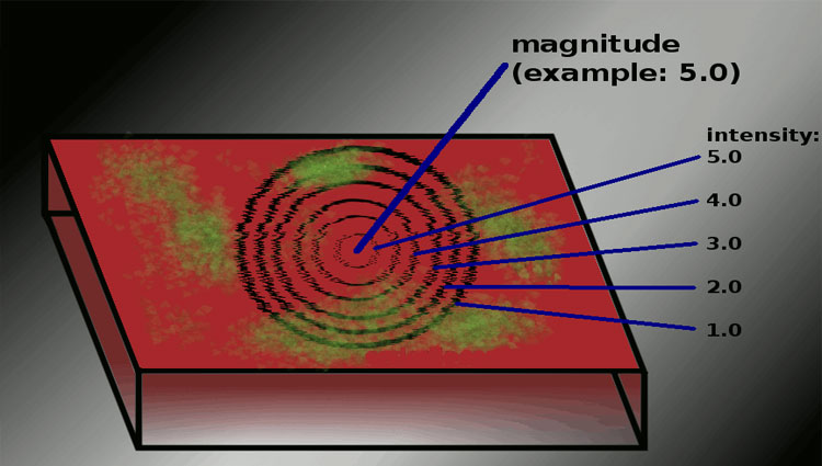
We often think of earthquakes in terms of their epicenter and magnitude, which are crucial for understanding the initial energy released. However, the ground shaking we experience during an earthquake, and consequently the damage caused, is far more nuanced than a simple Richter scale reading suggests. The story of an earthquake's impact is intricately tied to the very ground beneath our feet. Local geology plays a starring role, transforming the seismic waves as they travel upwards, either amplifying or dampening their effects, and ultimately dictating the intensity of shaking at the surface.
The Unseen Architect: Local Soil Conditions
One of the most significant factors influencing earthquake intensity is the type of soil present at a given location. Soft soils, such as those found in former bay areas or reclaimed land, tend to amplify seismic waves considerably. This amplification occurs because these loose, unconsolidated materials have a lower shear wave velocity than bedrock. As seismic waves transition from denser rock to softer soil, they slow down and their amplitude increases, much like waves bunching up as they approach a shoreline. This phenomenon is often referred to as soil amplification and can dramatically increase the shaking intensity experienced at the surface, leading to more severe damage.
Conversely, areas with dense, solid bedrock experience less amplification and, therefore, lower shaking intensity. This is why structures built directly on bedrock tend to fare better during earthquakes than those built on soft soils. Understanding the site response, or how a particular location responds to seismic waves, is crucial for engineers when designing earthquake-resistant structures.
Sedimentary Basins: A Recipe for Seismic Amplification
Sedimentary basins, geological depressions filled with layers of sediment, can act as natural amplifiers of earthquake shaking. These basins trap seismic waves, causing them to reverberate and bounce off the edges. This phenomenon, known as basin effects, prolongs the duration of shaking and can significantly increase the amplitude of seismic waves. Think of it like a bowl that keeps the sound echoing longer than it would in an open space.
The geometry of the basin also plays a role. Deeper and wider basins tend to amplify seismic waves more effectively. This means that even areas relatively far from the earthquake's epicenter but located within a sedimentary basin can experience surprisingly strong shaking and damage. Therefore, understanding the geotechnical properties of the basin is critical for accurate seismic hazard assessment.
The Role of Topography: Hills, Ridges, and Seismic Focusing
Topography, the shape of the land surface, can also influence earthquake intensity. Hills and ridges can act as lenses, focusing seismic waves and amplifying their effects. This topographic amplification can lead to increased shaking intensity on hilltops and ridge crests compared to surrounding flat areas. The shape and steepness of the slope determine the extent of amplification; sharper, steeper slopes tend to produce greater amplification.
Conversely, valleys can sometimes experience reduced shaking intensity due to the dispersion of seismic waves. However, complex terrain can also lead to interference patterns, where waves constructively interfere in some areas and destructively interfere in others, resulting in localized pockets of amplified or reduced shaking. These ground motion variations are essential for accurate hazard mapping.
Liquefaction: When Solid Ground Behaves Like Liquid
Liquefaction is a particularly devastating phenomenon that occurs when saturated, loose soils lose their strength and stiffness during an earthquake, behaving like a liquid. This can cause buildings to sink, tilt, or even collapse. Liquefaction is most common in sandy or silty soils that are saturated with water, such as those found near coastlines, riverbanks, and areas with a high water table.
The process of liquefaction involves the shaking from the earthquake causing the water pressure in the soil pores to increase, reducing the effective stress between soil particles. When the effective stress reaches zero, the soil loses its ability to support weight and behaves like a fluid. Mitigating the risk of liquefaction often involves improving soil drainage, densifying the soil, or using deep foundations that extend below the liquefiable layer. Seismic vulnerability assessments must always account for the potential of liquefaction in susceptible areas.
Fault Rupture and Surface Rupture: Direct Impact Zones
While much of the damage from earthquakes comes from ground shaking, the area directly above a fault rupture can experience even more severe effects. Surface rupture occurs when the fault breaks the surface of the earth, causing displacement of the ground. This can directly damage or destroy buildings, roads, and other infrastructure located on or near the fault line.
The amount of displacement varies depending on the magnitude of the earthquake and the type of fault. Areas along active fault lines are at the highest risk of surface rupture and should be avoided for development. Regulations often restrict building construction within designated fault zones to minimize potential damage and loss of life. Understanding earthquake hazard zones is crucial for effective land use planning.
The Influence of Underlying Geology: Rock Types and Wave Propagation
The type of rock beneath the soil also plays a significant role in determining earthquake intensity. Different rock types have different densities and elastic properties, which affect how seismic waves propagate through them. Harder, denser rocks generally transmit seismic waves more efficiently and with less attenuation (weakening) than softer, less dense rocks.
For example, sedimentary rocks, like sandstone and shale, tend to be less rigid than igneous rocks, like granite or basalt. This means that seismic waves will travel slower and be more attenuated in sedimentary rocks. This variability in wave propagation directly impacts the intensity of shaking at the surface. Detailed geological mapping is essential for understanding these variations and predicting potential earthquake hazards.
Construction Practices: Mitigating Geological Risks
Building codes and construction practices must account for local geological conditions to minimize earthquake damage. In areas with soft soils, buildings should be designed with deep foundations or ground improvement techniques to prevent settling or liquefaction. In areas prone to topographic amplification, structures should be reinforced to withstand the increased shaking intensity.
Engineers use a variety of techniques to mitigate geological risks, including soil stabilization, ground improvement, and the use of earthquake-resistant building materials. These techniques can significantly reduce the seismic risk associated with building in earthquake-prone areas. Regular updates to building codes based on the latest research and advancements in engineering are crucial for ensuring public safety.
Microzonation: Mapping Localized Seismic Hazards
Microzonation is the process of dividing an area into zones based on its earthquake hazard potential. This involves detailed geological and geotechnical investigations to identify areas with different levels of seismic risk. Factors considered in microzonation include soil type, topography, groundwater levels, and proximity to active faults.
Microzonation maps provide valuable information for land use planning, building design, and emergency preparedness. They can help identify areas where stricter building codes are needed or where development should be restricted. Microzonation is a critical tool for reducing earthquake vulnerability and mitigating the impact of future earthquakes.
| Geological Factor | Impact on Earthquake Intensity |
|---|---|
| Soft Soil | Amplifies shaking, increases duration |
| Sedimentary Basins | Traps and amplifies seismic waves |
| Topography (Hills/Ridges) | Focuses seismic waves, increases intensity |
| Liquefiable Soils | Causes ground failure and structural damage |
| Underlying Geology | Influences wave propagation and attenuation |
| Mitigation Strategy | Application |
|---|---|
| Ground Improvement | Stabilizing soft soils to prevent liquefaction |
| Deep Foundations | Extending foundations below unstable layers |
| Earthquake-Resistant Design | Reinforcing structures to withstand strong shaking |
| Land Use Planning | Restricting development in high-risk zones |
FAQ
Q: How can I find out about the soil conditions in my area?
A: Contact your local geological survey or engineering department. They may have information on soil types, groundwater levels, and other relevant geological data for your area. You can also consult geotechnical reports for specific construction sites.
Q: Is it safe to build on soft soil?
A: Building on soft soil is possible, but it requires careful engineering and construction practices. Structures must be designed to withstand the potential for amplified shaking and ground settlement. Ground improvement techniques, such as soil stabilization or deep foundations, may be necessary.
Q: How do sedimentary basins affect earthquake shaking?
A: Sedimentary basins trap seismic waves, causing them to reverberate and bounce off the edges. This amplifies the shaking and prolongs its duration, potentially leading to increased damage, even at locations far from the epicenter.
Q: What is the role of building codes in mitigating earthquake risks?
A: Building codes are designed to ensure that structures are built to withstand the forces of an earthquake. They specify requirements for foundation design, structural reinforcement, and the use of earthquake-resistant materials. Regularly updated building codes are crucial for mitigating earthquake risks.
Conclusion
While earthquake magnitude and epicenter location provide a crucial starting point, understanding the complexities of local geology is paramount for accurately assessing seismic hazard and mitigating potential damage. From soil amplification and sedimentary basin effects to topographic focusing and liquefaction, the ground beneath our feet plays a decisive role in shaping earthquake intensity. By incorporating geological considerations into building codes, land use planning, and emergency preparedness efforts, we can significantly reduce our vulnerability to earthquakes and build more resilient communities. As our understanding of these complex interactions grows, so too will our ability to predict and prepare for future seismic events, making us safer and more secure in the face of these natural disasters. Continued research into seismic hazard analysis is vital for improving our resilience.
