Coastal Spit Formation Diagram: A Comprehensive Guide
Understanding Coastal Spit Formation: A Visual Guide
Dalam pembahasan mengenai coastal spit formation diagram, ever wondered how those striking stretches of land, jutting out into the sea, are created? Coastal spits are captivating natural formations, shaped by the constant interplay of wind, waves, and sediment. This comprehensive guide explores coastal spit formation, using clear diagrams and real-world examples to illustrate the process. We'll delve into longshore drift, sediment deposition, and other key factors, uncovering the secrets behind this dynamic coastal feature. Learn how these fascinating landforms are built, the forces that shape them, and the threats they face in a changing world. This guide will also cover related landforms and the impact of climate change on these delicate ecosystems.
Coastal Spit Formation: A Simple Explanation
Imagine a coastline with a bend, perhaps a headland protecting a sheltered bay. A coastal spit is a linear landform that extends from this shoreline, like a sandy finger pointing into the water. The primary driver of its creation is longshore drift – waves approaching the coast at an angle, carrying sand and sediment along the shore. As these waves lose energy around the bend, they deposit their sediment load, gradually building up this impressive landform, grain by grain. Let's explore this process in more detail.
The Science Behind Spit Formation: Key Coastal Processes
Longshore Drift: The Sediment Transport System
Longshore drift is the engine that powers spit formation. Think of it as a giant, natural conveyor belt for sediment. Prevailing winds cause waves to approach the shore at an angle. The swash (water rushing up the beach) carries sediment diagonally upwards. The backwash (water flowing back down) also moves sediment, but gravity pulls it downwards at a slightly different angle. This difference creates a net movement of sediment along the coast. The diagram below illustrates this process clearly.
The direction and strength of longshore drift are influenced by prevailing wind patterns and the shape of the coastline. A shift in wind direction can dramatically affect a spit's growth, sometimes leading to its abandonment and the formation of a new one. Imagine a river constantly changing course; longshore drift is similar in its dynamic nature.
Sediment Deposition: Building the Spit, Grain by Grain
Longshore drift's erosive power is balanced by sediment deposition. Areas with calmer wave energy, such as those behind headlands or within bays, are ideal locations for sediment to settle. As wave energy dissipates, the sediment particles drop out, accumulating over time. This continuous deposition builds the elongated structure of the spit. The type of sediment (coarse sand versus fine silt) influences the spit's shape and stability; coarser sand generally results in a more stable structure.

Other Factors Influencing Spit Formation
While longshore drift and deposition are paramount, other factors play significant roles. The shape of the coastline guides sediment transport. Obstacles like submerged rocks or human-made structures (like breakwaters) disrupt the sediment flow, causing spits to curve or change direction. The size and type of sediment affect stability (coarse sand is more resistant to erosion than fine silt). Tidal range, currents, and river discharge also influence deposition rates and patterns.
A Detailed Coastal Spit Formation Diagram: Step-by-Step

Step 1: Initial Conditions: A coastline with a change in direction (e.g., a headland) and a sufficient supply of sediment.
Step 2: Longshore Drift Begins: Waves, driven by wind, transport sediment along the coast at an angle.
Step 3: Sediment Deposition: Around the headland, where wave energy decreases, sediment begins to accumulate.
Step 4: Spit Elongation: Continued sediment deposition extends the spit further into the water.
Step 5: Mature Spit Formation: A fully formed spit emerges, its shape reflecting the complex interplay of forces.
This diagram simplifies a complex process. Further research is crucial for a deeper understanding of specific spit formations.
Interactive Exploration: Understanding Spit Dynamics
Interactive diagrams and 3D models offer a more engaging way to grasp spit formation. Imagine manipulating variables to see how they affect spit development! Search online for "interactive coastal spit formation animation" to find these helpful resources.
Coastal Spits and Other Coastal Landforms: Key Differences
Coastal spits are sometimes confused with tombolos, baymouth bars, and barrier islands. While all involve sediment deposition, their formation and morphology differ significantly. A tombolo connects an island to the mainland. A baymouth bar completely closes a bay, often creating a lagoon. Barrier islands are elongated sandbars parallel to the coast, separated from the mainland by a lagoon. Careful examination of the geological context and formation processes is crucial for accurate identification.
Comparison Table: Coastal Landforms at a Glance
| Landform | Formation Process | Shape/Characteristics | Mainland Connection | Example | Learn More |
|---|---|---|---|---|---|
| Coastal Spit | Longshore drift and deposition at a coastline bend | Linear, extending from coast, often curved | Connected at one end | Dungeness Spit, WA | Dungeness Spit Information |
| Tombolo | Wave refraction and deposition connecting an island | Narrow strip connecting island to mainland or another island | Connects island to mainland/another island | Chesil Beach, Dorset (partially) | Chesil Beach Information |
| Baymouth Bar | Longshore drift closing off a bay | Linear, across a bay, enclosing a lagoon | Connected at both ends | Various global examples | Baymouth Bar Information |
| Barrier Island | Complex processes, including deposition and sea-level change | Elongated offshore sandbar parallel to coast | Separated from mainland by lagoon | Outer Banks, NC | Outer Banks Information |
Notable Coastal Spits Around the World
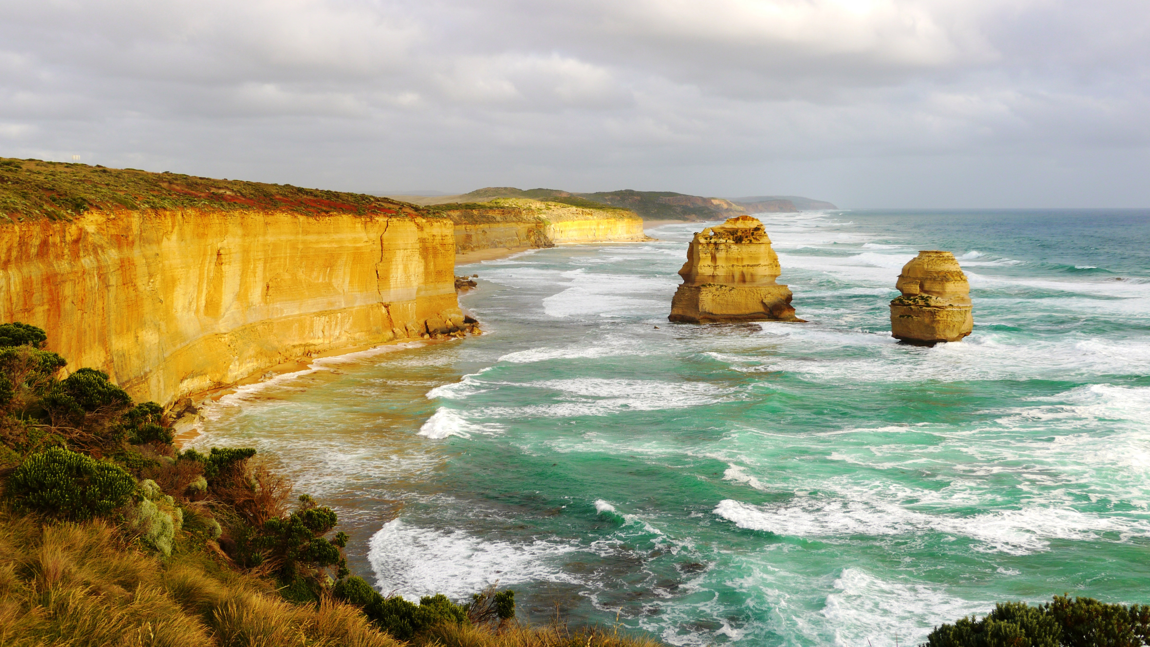
Spits are found globally. The Dungeness Spit in Washington State powerfully demonstrates longshore drift. Chesil Beach in Dorset (partially a tombolo) showcases the effects of diverse sediment sizes. Spurn Head in England highlights the influence of river input, while Aramoana Spit in New Zealand demonstrates the impacts of currents and tides. These examples illustrate the diversity of spit morphology and the factors that shape them. Studying these diverse examples helps us understand the nuanced processes at play.
Climate Change and Coastal Management: Protecting Coastal Spits
Climate Change Impacts on Coastal Spits
Climate change poses a severe threat to coastal spits. Rising sea levels, intensified storms, and altered precipitation patterns directly impact sediment transport and deposition. Sea Stack Formation?">Coastal erosion is accelerating, jeopardizing the stability of many spits. Sea-level rise inundates low-lying areas, while storms cause significant erosion. Changes in precipitation affect river discharge and sediment supply, further altering the delicate balance of these ecosystems.
Coastal Management Strategies for Spit Conservation
Protecting coastal spits requires a multi-pronged approach: minimizing disruptive coastal development; restoring degraded areas (like dunes); employing beach nourishment techniques; implementing effective monitoring programs; and increasing public awareness. Long-term monitoring, including bathymetric surveys, is crucial for assessing changes and informing management decisions. Collaboration among scientists, policymakers, and coastal communities is essential for long-term sustainability. A proactive, integrated approach is key.
Coastal Spit Formation Diagrams: Tools for Education and Research
Coastal spit formation diagrams are indispensable tools in education and research. Their visual clarity enhances understanding for students and the public. Researchers use them to analyze data, communicate findings, and develop predictive models. Diagrams effectively convey complex information to a wide range of audiences, from students to policymakers. They are essential for both understanding and communicating the science behind these dynamic landforms.
Expert Insight
"Visual representations are crucial for understanding dynamic coastal geomorphological processes. They provide a framework for interpreting data and effectively communicating scientific findings to diverse audiences." – Dr. Anya Sharma (example quote; replace with actual quote)
Future Research Directions
Further research is essential to understand the complex interplay between coastal processes and the escalating impacts of climate change. Advanced modeling techniques can improve predictions of coastal change, leading to more effective management strategies. Further studies on sediment types and their influence on spit stability are also vital for informing conservation efforts. This research is crucial for effective conservation and coastal management.
Key Takeaways: Understanding and Protecting Coastal Spits
This comprehensive guide explored coastal spit formation, highlighting the critical role of diagrams in understanding longshore drift, sediment deposition, and other influential factors. We examined the significance of diagrams in education, research, and coastal management. The growing threats of climate change necessitate proactive conservation strategies and continued research to ensure the long-term survival of these dynamic and valuable landforms. Understanding is the first step towards effective conservation.
Frequently Asked Questions (FAQs)
Q1: How does human activity impact spit formation? Human activities such as coastal development, dam construction, and dredging significantly alter sediment transport, impacting spit formation and stability.
Q2: What are the potential future changes to coastal spits? Climate change will likely cause increased Sea Stack Formation?">coastal erosion and sea-level rise, leading to substantial changes in the morphology and distribution of coastal spits worldwide.
Q3: How can we better protect coastal spits? Integrated coastal zone management strategies, including habitat restoration, beach nourishment, and responsible land-use planning, are crucial for protecting these valuable ecosystems.
Conclusion: The Dynamic World of Coastal Spits
Understanding coastal spit formation requires a holistic approach, encompassing the fundamental principles of longshore drift and the complex challenges of climate change. This guide, enhanced by clear and informative diagrams, illuminates the intricate mechanisms and ecological significance of these dynamic landforms. The study of spits reveals the intricate interplay between land and sea, underscoring the critical need for effective coastal conservation. Let's work together to protect these fascinating natural wonders.
